Category Archives: Wales

Light and Dark

Craig Eigiau and Carnedd Llewellyn – 20-Nov-2011

The met office forecast had sounded so promising for an inversion – low level hill fog, but higher summits over 800m should be clear.  Driving up to the pass from Llangynog the fog was certainly thick. and it cleared just at the top of the pass, rolling off the surrounding hills. Things continued to be promising as I drove past Cerrigydrudion, with the thermometer reading just 1°, and frost thick on the ground.

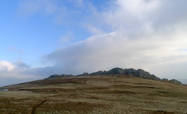
But, by the time I reached the gated road into Cwm Eigiau the fog had gone, with some cloud hanging high over the ridge at the far end of the cwm.

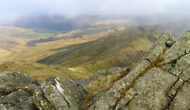
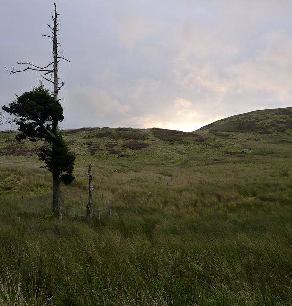
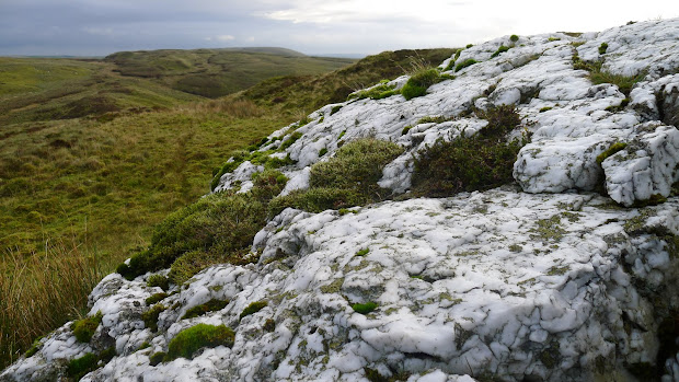
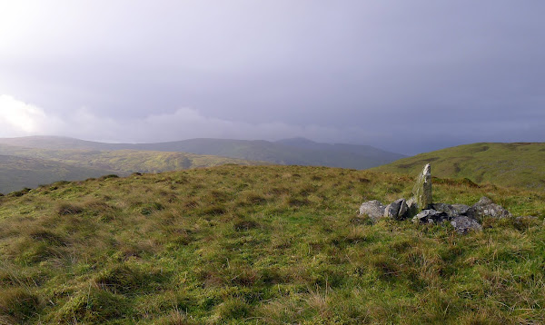
I took the path NW from the parking, and headed round the end of the ridge before cutting up onto the crest and following the wall to Craig Eigiau. the glacier-smoothed rocky rib at the summit is a pleasant change from the shattered rock on the higher Carneddau peaks  – a sign that they remained above the glacial ice.

From here, there’s a large plateau that leads onto the broad ridge between Carnedd Llewellyn and Foel Grach. I kept towards the south of it, partly for the views over to the cliffs of Craig yr Ysfa – glistening in the sun- and also also to try and scope out a route back through the cwm.

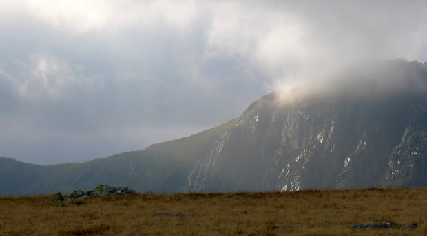
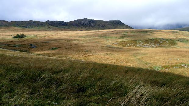
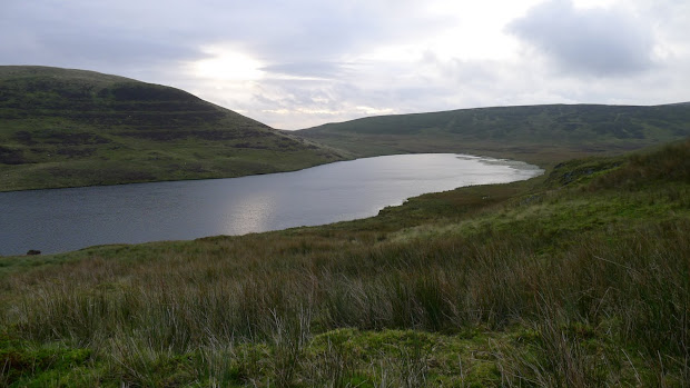
After catching a glimpse of the waters at Ffynnon Llyffant it was time to head on towards a fog-shrouded Carnedd Llewellyn. The Northern slopes have numerous boulder fields, and few obvious paths. The rocks were all incredibly greasy and I was relieved to reach the comparative easy going of the summit plateau.

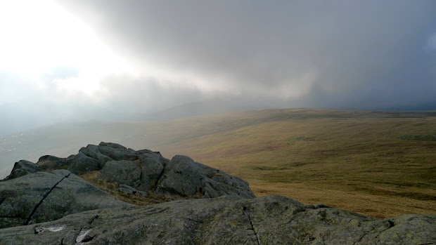
The summit had been tantalisingly peeking in and out of cloud as I climbed, but now the cloud showed no signs of budging. After lunch and a quick litter-pick of the windshelter (what part of ‘Leave No Trace‘ don’t people understand?) , I’d planned to head onwards Yr Elen, but the cloud base had dropped significantly (and the wind had really picked up) so Yr Elen has been saved for a better day.

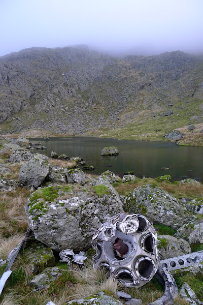
I retraced my steps a little, then headed down into Ffynnon Llyffant. I was aware there’d been an air crash near here – a Canberra from RAF Pershore – but the extent and distribution of the wreckage was a surprise. Even half a mile or more downstream you’ll see large aluminium panels in the water, carried down by floods.

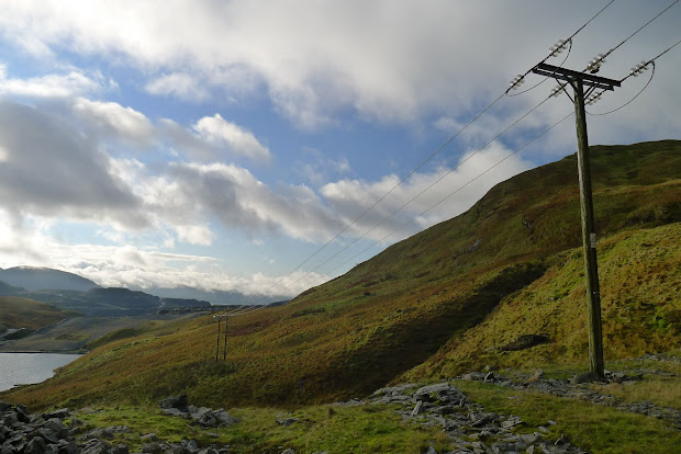
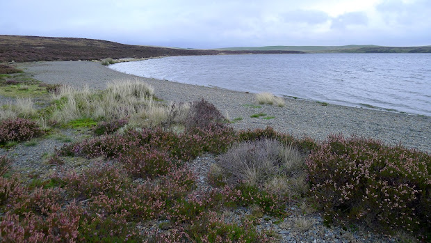
From here it’s a pleasant but pathless walk to the old mine workings. just following the course of the stream. The “road” out from here takes you past Cwm Eigiau Cottage (Rugby Mountaineering Club’s bothy) which is sporting a smart new roof, past the much-diminished Llyn Eigiau reservoir and the breached dam walls, with a mile of easy walking back to the car park.

Download file for GPS


Don’t forget your gaiters…

Allt Fawr, Moel Drumau and Ysgafell Wen – Oct 16th, 2011

On reflection, maybe mid-Wales isn’t the boggiest part of the country….

It was dark when I left home, and – as the coffee grinder would have woken the whole house – I was minus my caffeine fix. Betws-y-Coed was as far as I could get without one, so I was delighted to find that the Alpine Coffee Shop was open from 8AM, with proper coffee and a great fryup.  I headed back towards Blaenau Ffestiniog, and parked up at the top of the Crimea Pass. Today’s plan was to explore the hills NW of Blaenau, and brush up on my navigation on unfamiliar ground in what should have been generally bright conditions.

Snowdonia is the only National Park with a ‘hole’ in the middle, and Blaenau sits in that hole. I’d always thought this was because the devastation caused by the slate mining made the place too much of an eyesore for inclusion, but Wikipedia reckons this was done to allow new industry to take over from slate mining without the additional planning restrictions associated with National Parks.

My first objective was Allt Fawr, and initially, the slate quarries are what draws the eye. The wide track in ends by a row of pylons crossing the hills, and a ventilation tunnel for the 3,000m long railway tunnel deep beneath. But climbing higher the quarries disappeared from view. with just some road noise from the A470 remaining. I lost count of the number of lakes and reservoirs on this walk, but the first (and probably least stunning) is Llyn Iwerddon, below Allt Fawr. Like many, this has been dammed to form a reservoir.

The cloud cover was pretty extensive, and the base was sitting at around 650m for most of the day, just covering the peaks, and hiding the quarries to the south. I headed down out of the cloud, towards the lakes below Moel Drumau.

The track shown on the 1:25000 map doesn’t exist on the ground, but the terrain is straightforward and the lakes big enough not to miss. From here, there’s a handy fenceline which you could follow all the way to Carnedd y Cribau, with minor detours to the several peaks of Ysgafell Wen. While it wasn’t raining, there was enough moisture around to make the rocks and grass incredibly slippery, and the ground can feel like a giant boggy sponge in places. After reaching and admiring Llyn Edno, (and a quick bite to eat), I headed down east into the cwm to pick up the path heading to Coed Mawr. Like the paths, streams can irritatingly disappear from the ground even though they’re marked on the map, so matching the terrain to the contours becomes essential.


Once there, the path across the valley to Hendre was again a figment of some demented surveyor’s imagination, so a minor diversion was called for. At Hendre, you pass under the railway line in a beautifully constructed tunnel which spits you out onto the  hillside below Moel Dyrnogydd.

This should have been the home straight now – just a couple of K to the car – except that it’s a 200m climb, through boggy terrain with – once again – an almost total absence of the marked path. Suffice to say expletives were uttered.

Download file for GPS

View in Google Earth

Name that Fungus?

Just on the margins of Glaslyn, I saw these small, white fungi poking their heads out of the gravel. No idea what they are, but 500m up, on the exposed and windswept gravel shore of an oligotrophic lake seemed an odd location for something so fragile-looking.

Foxes and Rainbows

Plans for an ultra-early start from home ended badly when I found the car had decided to jettison its PAS fluid all over the drive. None in the shed, so I had to wrestle it 15 miles to the nearest garage before driving up the mountain road from Llani towards the Glaslyn Nature Reserve. There’s a small parking area 100m from the lake shore, with a path leading into the reserve.

Glaslyn is an Oligotrophic lake with very low nutrient levels – there’s no watercourses feeding it, just the plentiful Welsh rain keeping it full. From the lakeside, you can follow a path up to a viewpoint overlooking the impressive ravine to the north, formed when the glacial meltwater on the plateau was finally released and surged over the edge.

Halfway round the lake, I cut across the heather towards Bugeilyn – another lake, but this time stream-fed. As you drop down towards it past the ruined farmhouse, Plynlimon and the Hengwm valley come into view. Today the tops were hiding in cloud, but I was heading for the lower hills to the north of the valley.

Just below the top of Foel Isaf, a fox appeared just 100m away. I was walking into the wind, and was able to watch for almost a minute before he spotted me and disappeared. The zoom on the LX5 is a piffling 120mm equivalent – great for portraits, but  hardly ideal for wildlife shots!

The terrain here is a mix of the typical mid-Wales peat, with a covering of heather, bilberry and crowberry. There are some truly horrible tussocky sections lying in wait to twist your ankles, but also some gorgeous quartz outcrops, looking almost edible in the morning light.

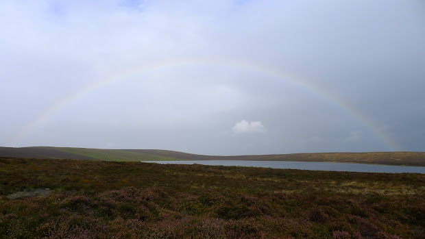
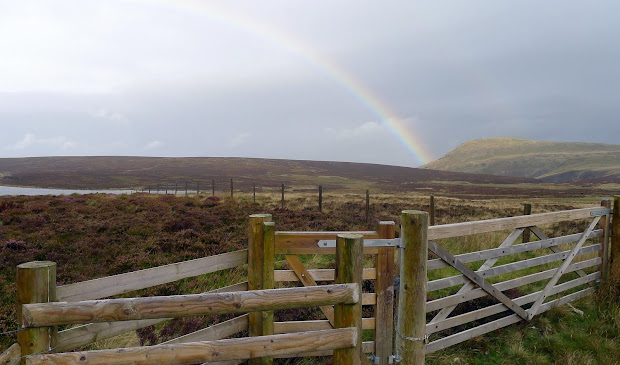
After food and a coffee by the lightly cairned top, the weather was definitely changing for the worse. That (and my sick car) made up my mind for me, and I decided to call it a day. I headed back on the path towards Glaslyn in steadily worsening drizzle, but was met at the lake by a stunning rainbow.