Category Archives: Wales

The Frozen Sponge

Pumlumon : 2/2/2012

Despite living just on the ‘wrong’ (Shropshire) side of Offa’s Dyke,  Powys always feels rather like ‘home’. We regularly visit or shop in Newtown, Welshpool, Llani and Hay, and many of my favourite hills are in Powys: The Black Mountains, Mynydd Du, and of course, Pumlumon (although the border with Ceredigion runs along the plateau).

I chanced upon Mike Parker’s “Real Powys” recently, and it’s one of the most entertaining books I’ve read for a long time. It’s billed as a ‘psychogeography’  of Powys – but don’t let that put you off: It’s sharply written, very funny and stuffed full of odd details and great anecdotes while underneath it all runs a huge dose of affection for his home county. If you live in or near Powys – or even just fly in occasionally to T3 at Llandegley International Airport, it’s a great read.

However, I suspect Pumlumon isn’t one of his favourite mountains. He describes it as:

Pumlumon … that great upland sponge that squats like a fat toad at the centre of Wales. At least the grey miasma oozing out of the slopes had successfully blotted out most of the two hundred wind turbines that now encircle it

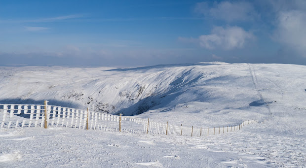
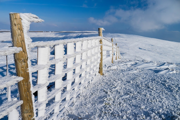
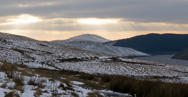
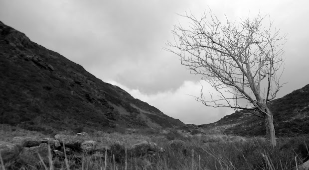
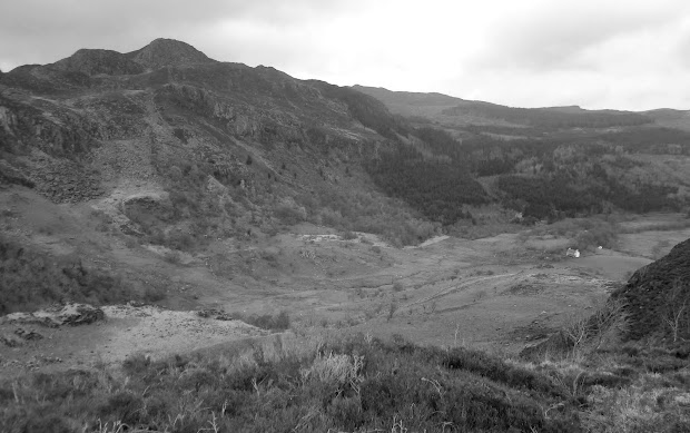
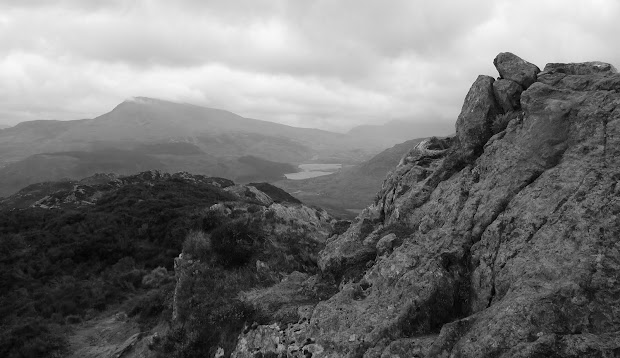
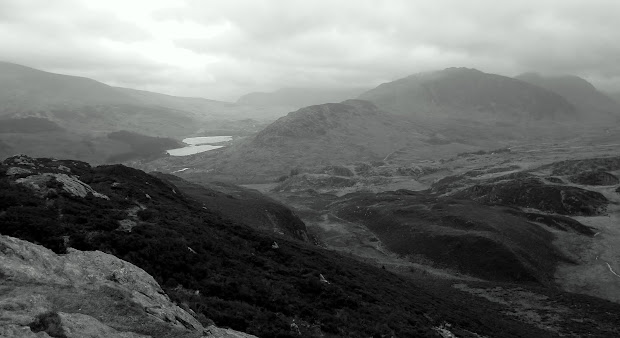
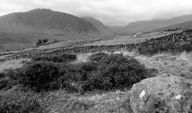
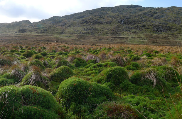
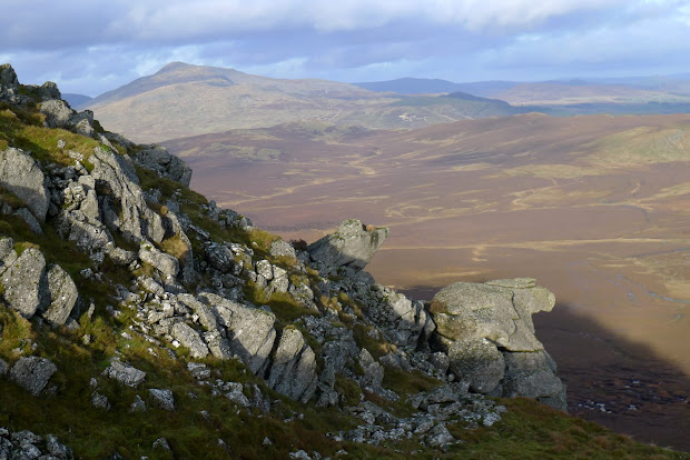
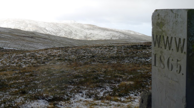
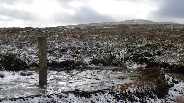
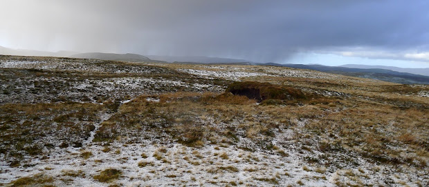
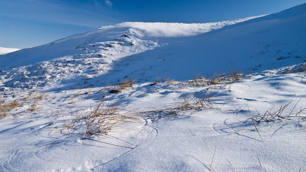
Unlike him, I seem to be always drawn back here. When I can’t make my mind up where to go, the answer is always this: Pumlumon. While the convenience is a factor, the remoteness is the magnet that brings me back time and again. As I’ve mentioned before, there’s plenty of signs of man’s presence here, but hardly anything that feels ‘contemporary’. Even the Outdoor Centre at Maesnant looks as though nobody has stayed there for years. With the remains of unused sheepfolds and age-old cairns, it can feel like a dead landscape, just waiting to be explored .

And on a day like Thursday, when it’s cold, white, and the wind has filled the paths and footsteps of everyone else with blown powder snow, it’s just a great place to be.

Download file for GPS

Monochrome

Crimpiau and Craig Wen – 20/1/2012

Yesterday, I found myself on top of Bury Ditches hillfort with the dogs, a glorious sunset, and a camera.

Sadly, the camera claimed there was “No battery power remaining”. (Splitting hairs: How did it manage to display that message, then?) So, no photos.

But today I’m in Snowdonia (writing this now in the Tanronnen Inn in Beddgelert – good pub food) and have a fully charged camera. But, not a glimmer of sunlight – cloud everywhere.

Met Office Mountain Forecast

The forecast this morning was pretty grim, so I decided to wait and see what looked sensible when I got there. All the high hills were cloaked in cloud, but Creigiau Gleision and the other hills NE of Capel Curig looked OK for a quick afternoon outing – and, the rain seemed to have held off.

Path to Crimpiau from Capel Curig

I parked up behind Joe Brown’s, and headed up towards Crimpiau. Even with the cloud, the views are pretty stunning. There are few places in the park where you can see both Llyn Ogwen and Lynnau Mymbyr. Looking northeast, the valley holding Llyn Crafnant looked worth exploring as well on another day.

Crafnant Valley from Crimpiau

Lynnau Mymbwr from Crimpiau

I dropped down into the bwlch leading up to Craig Wen, and the wind was really picking up, with gusts up to 45MPH. From here, a wall shows the obvious route up towards the top. Craig Wen has two adjacent tops which seem almost identical in height – I guessed (correctly, it transpires) that the furthest one was the higher. I passed on the scramble up wet, moss-covered rocks from the south, and found a simple walk up from the other side.

Tryfan and Glyders from Craig Wen

With the wind still strong – and limited daylight – I headed down across country to the bridge over the leat below Llyn Cowlyd. From here there’s a good, if muddy, path back to the A5 and a few 100 metres of road back to Capel Curig.

Gallt yr Ogof


Cup Lichen

Download file for GPS

Rhobell Fawr and Dduallt

Jim Perrin’s article about locating the source of the Dee was the ‘push’ that I needed. I’d been thinking about walking Rhobell Fawr and Dduallt for a while, but as soon as you get to Dolgellau, the ‘honey-pot’ hills of the Glyderau and Carneddau have a strange magnetic attraction that makes you reluctant to stop driving.

Thursday’s weather forecast was a help, too. Hill fog for most of the morning in the west, generally better in the east. Driving over Bwlch Oerddrws, I thought they’d got it wrong again, as there was low cloud and torrential rain, and the waterfalls coming down from Craig Wen looked stupendous. But, coming down the other side, the weather had cleared: Cadair Idris and the Rhinogs were in the cloud, but Rhobell Fawr was clearly visible under blue skies.

I’d planned a circular route from Rhydymain, taking in Rhobell Fawr and Dduallt with hopefully not too much forest-bashing or bog-trotting, and – given the rain of the last few weeks – no major watercourses to cross. I parked near the village hall, and headed up behind the chapel. A minor navigational error took me past the local hunt kennels, but soon I was climbing up towards the forestry track.

There was a feel of spring instead of winter in the air – buds forming in the hedgerows, and no frost at all. A friendly and talkative farmer at the road end corrected my pronunciation of the hill names, while his dog disappeared after a runaway sheep.

The section on the forestry track isn’t the most exciting part of the walk, but it does get you to the start of the rocky bits quickly and painlessly. And, there’s plenty of rock here, but well interspersed with grass and moss. While there’s a little scope for scrambling, most of the time hands aren’t required. The ascent is totally pathless – a case of picking your way through outcrops and streams, and generally heading uphill.

I had a quick snack before the final climb, and when you hit the top the panorama is incredibly impressive. Because Rhobell Fawr stands remote from most other hills the views are uninterrupted. Aran Fawddwy, Cadair Idris and Rhinog Fawr were still stuck with heads in the cloud, but Arenig Fawr and Moel Llyfnant to the north were both clear. Further away the higher mountains in Snowdonia were visible, but well covered in cloud.

From the summit I headed east down to the forest edge. Amazingly for such a remote peak, Ddualt is actually signposted off the forest track. But the track through the forest is far from good, with fallen trees to clamber round or under. I was glad to reach the stile and the open hillside again. There’s no path to the south ridge so just slowly following the line of least resistance seems to work. More heather here, and generally wetter terrain then Rhobell Fawr, but once you reach the ridge it’s an easy climb over rocky steps. There are great views down to the marsh of Daear Sinc, where the river Dee rises, although Perrin’s ‘capel’ is hidden from sight.

I wasn’t planning to hunt out the source myself today, but headed south down through the crags to the edge of the marsh, and cut across to the higher and drier land east of the Afon Eiddon. From here, a tiny trace of a track takes you along towards the river, as it heads through the impressive ravine of Cyfyng y Benglog. The walk out through the moss-covered broadleaf woodland is a pleasant change from the conifers on the other side of the river.

Dropping down to the farm at Pen y Rhiw the footpath becomes very indistinct, so I carefully trespassed back to the road as the sun was setting.

Download file for GPS

Blowing away the Cobwebs

For several weeks now, I’ve been waiting for a day when the weather forecast and my diary were in some form of alignment. With the Met Office forecasting mere gales with only a ‘low’ risk of severe wind chill (rather than last weeks storms and torrential rain) and a possible sprinkling of white stuff, today seemed a good bet.

I set off for Plynlimon with an encouraging heavy frost on the ground, and only a few patches of black ice on the road. Given the marginal conditions and limited daylight, a hill close to home had seemed a good idea, and an approach through the forestry from Rhyd-y-bench would keep me out of the wind for some of the ascent.

The Severn Way follows the nascent River Severn, now heavy with rain, up over numerous small waterfalls and rock steps. It’s a great place to bring kids in summer, but the river is a lot less impressive then.

Climbing out through the recently felled upper sections, the hills above were sparsely coated with white, but the ground was nowhere near frozen, with ice just starting to form on a few of the puddles.

I took the main path to the source of the Severn, handily marked by a large wooden post, and the onto the boundary marker and cairn just beyond. From here you can see across the Hengwm valley to the hills beyond, and today the visibility was good enough to see Cadair Idris. More importantly, I also could see a large dark cloud heading rapidly towards me: I expected rain or snow, but got neither: Hail, carried by a 40MPH wind, is rather like being sandblasted by frozen peas. I tweaked my hood and buff to reduce the available target area and headed on into the wind towards Pen Pumlumon Arwystli.

I ducked into the windshelter scooped from the top of one of the ancient cairns to fix lunch and a coffee, but the freezing temperature and near-empty gas cylinder I’d brought meant that the water took ages to boil. I’d planned to head on to Pumlumon Fawr, but given the wind – and yet more black clouds heading my way – decided to head back instead. The snow caught up with me just as I reached the shelter of the trees, but didn’t last long.

The walk back down through the forest was pleasant, reinforced by a mince pie kindly offered by a large group out with their dogs. A lot of the lower-lying snow had melted, and the forecast seems set for rain again.

Download file for GPS